Land Survey and Analysis

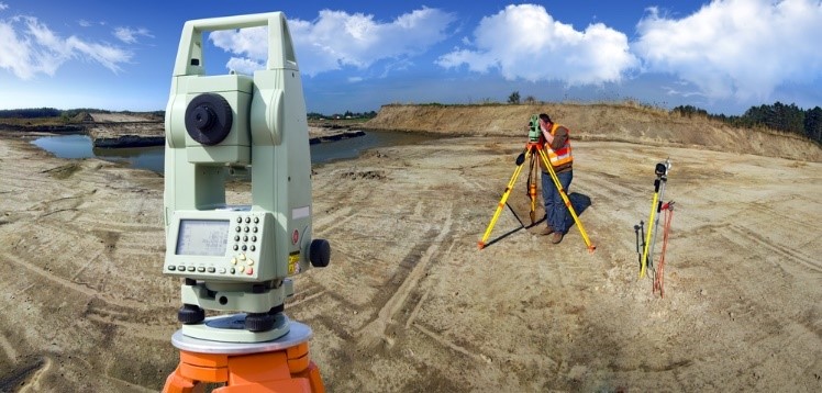
Axiom survey group, namely, Kurdinate Group, with more than 19 years of successful experience has surveyed about 23,000 hectares of lands, 835 km of river and transportation lines of oil, gas, water, etc. and has provided their topography maps. In addition, 1200 km of gas pipelines have been surveyed and as-built maps were delivered. 240 km of gas and water pipelines were surveyed in order to provide enough supply of these materials for 70 villages. Kurdinate Group having a huge variety of featured hardware and software is capable of surveying any existing objects based on employers’ precision requirements. Some of the groups’ equipment are mentioned hereafter.
Projects involved
  • The topography of the Zarde Kamardam in Bijar County, Regional Water Org., Kurdistan Province, Iran
  • The topography of the underground water tunnel route in the city of Piranshahr, Regional Water Org., Western azarbayjan Province, Iran
  • Mapping project under construction in the town of parand, Companies build new cities, Tehran Province, Iran
Projects involved
  • Haj Omran, choman, Khalifan, Diana, Hareir –Shaqlaveh, and Sulaymaniyah state, Kurdistan, Iraq
  • Dam Amand, dam Inchehand dam Darband, Regional Water Org., Khorasan shomali Province, Iran
  • Babanar, Regional Water Org., Fars Province, Iran
  • Korahrood, Gharechay and Khondab, Regional Water Org., Markazi Province, Iran
  • Pol-e-dokhtar, Regional Water Org., Lorestan Province, Iran
Projects involved
  • Preparation of maps for use in a GIS, the customs of Imam Khomeini port, Customs Organization 's, Khuzestan Province, Iran
  • Mapping project under construction road in the Sonqor city, Department of Roads and Urban Development, Kermanshah Province, Iran
  • The cadastral and topographic map, area of 1200 hectares of the agricultural Robat karim city, Agricultural Org., Tehran Province, Iran
  • The Mapping interactions of land, an area of 7300 hectares in Hamedan Province, Agricultural Org., Hamedan Province, Iran
  • Services bathymetry and sea bed profiling Lake Orumia, length of 120 km, Revival Center Lake Orumia, Western Azerbaijan Province, Iran
  • The topographic map (Scale of 1/2000) and the implementation of Axis Mehran-Dehloran-Andimeshk, length of 120 km, Department of Roads and Urban Development, Ilam Province, Iran
  • The topographic map (Scale of 1/500) from intersections road in Shahriar city, length of 9 km, Shahriar Municipality, Alborz Province, Iran
  • The cadastral and topographic map, area of 1400 hectares of agriculture and orchards in Kermanshah Province, Agricultural Org., Kermanshah Province, Iran
  • Preparation of topographic map with a scale of 1/2000 From Kashan County, length of 60 km, Regional Water org., Esfahan Province, Iran
  • The cadastral and topographic map, with a scale of 1/2000 from the rivers of Hamedan city, length of 70km, Regional Water org., Hamedan Province, Iran
  • Preparation a map of gas As-built (Scale of 1/200) In the cities Borujerd and Azna, length of 800 km, Gas Co., Lorestan province, Iran
  • And a lot of other projects which could be represented by employer order.
Projects involved
  • Jegeindam and the Canal in Jask County, Eiseindam and the Canal in Bandar abas County, Regional Water Org., Hormozgan Province, Iran
  • Water Canals of the Hajiandam in Gasrshirin, Regional Water Authority, Kermanshah Province, Iran
  • Harvest profiles and the topography of the Tiror river in Minab County, Regional Water Or., Hormozgan Province, Iran
  • Harvest profiles and the topography of the River in the cities of Delijanand Khomein, Regional Water Org., MarkaziProvince, Iran
  • The topography of the Changolehdam and the Canal in Mehran County, Regional Water Org., Ilam Province, Iran
  • The topography of the Gabrikdam in JaskCounty, Regional Water Org., Hormozgan Province, Iran
  • topography of the wastewater, in the towns of Bushehr, Genavehport of Daylamport, Water and Wastewater Authority, Boshehr Province, Iran